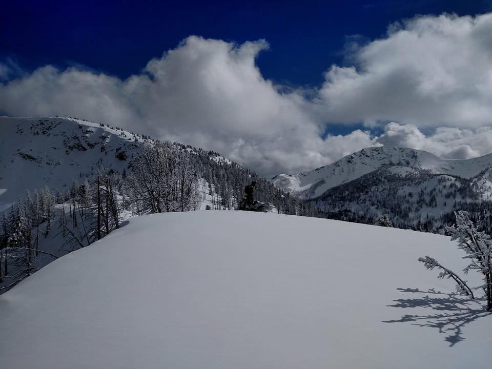
Goat Creek Area
Ride prepared. Check current avalanche, weather, closure, and road information with the linked authority before departure.
Open/Close Dates
RMSC resourceUnknown
Avalanche Conditions
RMSC resourceNorthwest Avalanche Center Avalanche.org
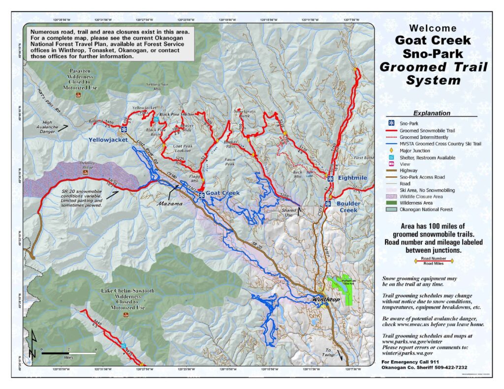
Trail Map
RMSC resourceClick to View
Goat Creek
RMSC resourceDirections: 16 miles northwest of Winthrop. Cross Wyman Bridge, Goat Creek County Road south for 2 miles to USFS Road 52 for .25 mile Elevation: 2,200 feet 20 spaces. Trails: 1.) 5225 / 100 / 500 / 52 / Goat Peak Loop Trail system 100 miles No sanitary facilities, snow shelter Sno-Park Permit Required November thru April or as posted. Please obey posted signs indicating whether a permit is needed. Contact the local agency listed for each Sno-Park for more information. Please note: After periods of extreme weather, work crews may be on trails during the day to clear debris or drifts. Please exercise caution.
Yellow Jacket
RMSC resourceDirections: 6.9 miles west of Mazama. Lost River Road/County Road 9140 west to Yellowjacket Road north for .5 mile Elevation: 2,400 feet 50 spaces. Trails: 1.) 100 / 600 / Yellowjacket / Black Pine Basin Trail system 100 miles No sanitary facilities, shelter Sno-Park Permit Required November thru April or as posted.
Silver Star
RMSC resourceDirections: 15 miles nw of Winthrop on highway 20 at end of plowed road. Parking: 100 vehicles. 1 upper lot and 1 low lot, parallel and angle park on side of highway. Amenities: Toilet & Kiosk Trails: 1.) 5225 / 100 / 500 / 52 / Goat Peak Loop Trail system 100 miles Sanitary facilities, kiosk Sno-Park Permit Required November thru April or as posted. Please obey posted signs indicating whether a permit is needed. Contact the local agency listed for each Sno-Park for more information. Please note: After periods of extreme weather, work crews may be on trails during the day to clear debris or drifts. Please exercise caution.
Nearest Snotel
RMSC resourceHarts Pass 6490 ft Rainy Pass 4890 ft MAP
Weather
RMSC resourceForecast for Goat Creek area

Search & Rescue
RMSC resourceOkanogan County Sheriff’s Office Call 911 or (509 )-422-7200
Snowmobile Clubs
RMSC resourceMethow Valley Snowmobile Association
Parking
RMSC resource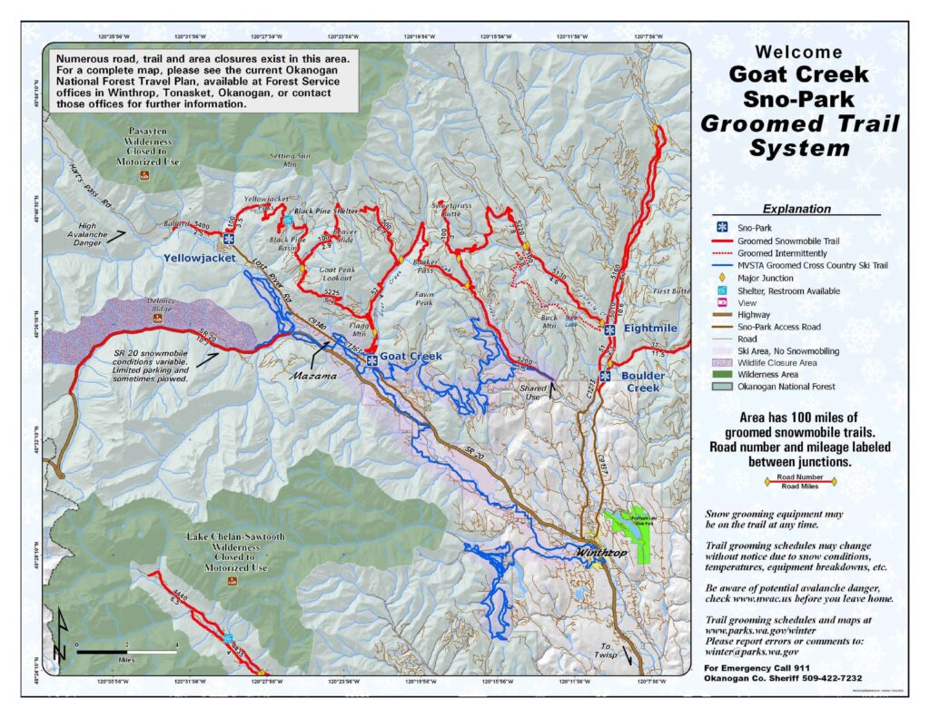
Goat Creek
RMSC resourceDirections: 16 miles northwest of Winthrop. Cross Wyman Bridge, Goat Creek County Road south for 2 miles to USFS Road 52 for .25 mile Elevation: 2,200 feet 20 spaces.
Yellow Jacket
RMSC resourceDirections: 6.9 miles west of Mazama. Lost River Road/County Road 9140 west to Yellowjacket Road north for .5 mile Elevation: 2,400 feet 50 spaces.
Silver Star
RMSC resourceDirections: 15 miles nw of Winthrop on highway 20 at end of plowed road. Parking: 100 vehicles. 1 upper lot and 1 low lot, parallel and angle park on side of highway. Amenities: Toilet & Kiosk
User Permits
RMSC resourceGet Permits Now
Products & Services
RMSC resourceYour one stop shop for aftermarket snowmobile parts and accessories Mountain Side Performance Kremmling, CO (970) 406-2722 Marlenee LLC Excavation & Marlenee Photography 6790 Hillside Drive Idaho Falls, ID 83401 (970) 227-7977 List Your Business with Us


Lodging
RMSC resourceList Your Business with Us
Road Conditions
RMSC resourceWashington State Department of Transportation